
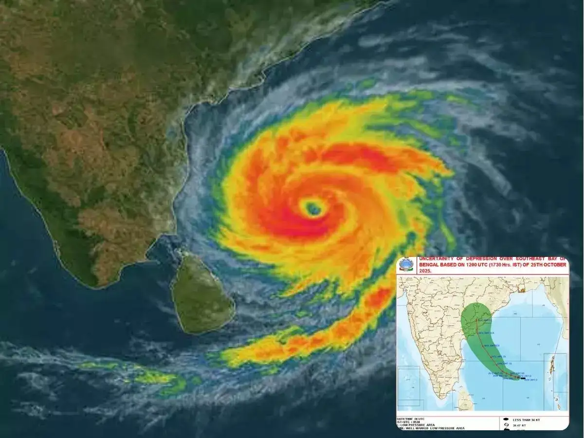
Cyclone Montha Intensifies in Bay of Bengal, to Make Landfall Near Andhra Pradesh Coast on October 28
Cyclone Montha has formed over the Bay of Bengal and is steadily moving toward the Andhra Pradesh coast at a speed of 13 km per hour, according to the India Meteorological Department (IMD). The system, which developed from a deep depression late Sunday night, has now intensified into a cyclonic storm. As of Monday morning, it was centered approximately 860 km from Gopalpur and 710 km from Kakinada. The IMD forecasts that Montha will strengthen into a severe cyclonic storm by the morning of October 28, making landfall near Kakinada with wind speeds between 90–100 kmph, gusting up to 110 kmph.
Under the cyclone’s influence, the weather pattern across coastal Odisha and northern Andhra Pradesh is expected to change significantly. The Regional Meteorological Centre in Bhubaneswar has issued a red warning for Gajapati, Ganjam, Rayagada, Koraput, and Malkangiri, forecasting heavy to very heavy rainfall until October 29. Additionally, an orange alert has been issued for Puri, Ganjam, and Gajapati districts, where wind speeds may reach 30–50 kmph, accompanied by thunder and lightning. The IMD has cautioned that from Monday morning through Tuesday, winds could intensify up to 60–80 kmph in southern Odisha districts.
The impact of Montha is also likely to extend inland, bringing strong winds and heavy rainfall to Nabarangpur, Kalahandi, Kandhamal, Nayagarh, Khurda, and Puri districts. A red warning for severe weather remains in effect for Rayagada, Malkangiri, Koraput, and Kalahandi for the next 24 hours. Fishermen have been strictly advised not to venture into the sea until October 29, as rough sea conditions are expected to prevail along the coast. The IMD has also hoisted Danger Signal No. 1 at all ports in Odisha as authorities prepare for possible flooding, power disruptions, and crop damage in the affected areas.
ALSO READ: The Spiritual Significance of the Lotus