Melisa strom affect which area
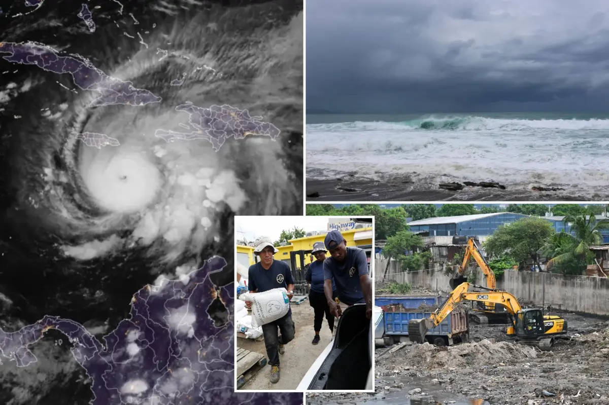
Three deaths and it hasn’t even made landfall yet. We are talking about Hurricane Melissa, which is barrelling towards Jamaica and is expected to be the most powerful hurricane to ever make a direct hit on the island.
In fact, Jamaican Prime Minister Andrew Holness warned on Monday (October 27) that if the Category 5 storm was to hit with full force then “I don’t believe there is any infrastructure within this region that could withstand a Category 5 storm, so there could be significant dislocation”.
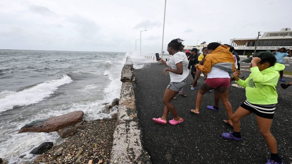
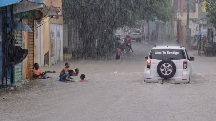
Jamaican officials have called on the public to get to higher ground and shelters before Melissa makes a landfall, expected today (October 28). According to the National Hurricane Centre (NHC) in the United States, the storm will cause “destructive winds” and “catastrophic flooding”, which it forecast to worsen throughout the day and night.
Now, as people prepare for the storm, we take a closer look at just what makes it strongest storm on the planet this year and what it means for the people of Jamaica.
Hurricane Melissa: From tropical storm to Category 5 in few days
What makes Hurricane Melissa particularly dangerous is that it has undergone, what experts call rapid intensification — a climate-charged phenomenon that’s increasingly sending devastating storms to the region.
On Saturday morning, Melissa was still just a tropical storm. But in under a day, the storm’s wind speeds increased from about 115 kilometres per hour to 225 kilometres per hour on Sunday. By Monday morning, it had become a Category 5 hurricane, one of the fastest intensifications ever seen in the Caribbean.
By that afternoon, the winds reached speeds of 281 kilometres per hour, according to the US NHC, making it the strongest storm on the planet so far in 2025.

But what caused this rapid transformation of the storm? According to scientists, it is probably a symptom of the rapid heating of the world’s oceans. “That part of the Atlantic is extremely warm right now – around 30 degrees Celsius [86 degrees Fahrenheit], which is 2 to 3C above normal,” said Akshay Deoras, a meteorologist at the University of Reading, in the United Kingdom. “And it’s not just the surface. The deeper layers of the ocean are also unusually warm, providing a vast reservoir of energy for the storm.”
Bernadette Woods Placky, chief meteorologist at Climate Central, a US-based research group, also agreed that Hurricane Melissa underwent rapid intensification and pointed the finger at climate change. “It does not mean that every single tropical cyclone is going to go through rapid or super-rapid intensification. However, in our warmer world, it will continue to increase the likelihood of storms going through rapid and super-rapid intensification,” she was quoted as telling The Guardian.
And science shows that the experts are correct. A 2023 study found that Atlantic hurricanes are now more than twice as likely as before to intensify rapidly from minor storms to powerful and catastrophic events. The rapid intensification of Hurricane Melissa also complicates disaster preparations — officials might be preparing for a weaker storm, only to suddenly face one far worse.
Slow-moving Melissa likely to cause more destruction
While Hurricane Melissa went from being a tropical storm to a Category 5 storm in just a few days, scientists tracking it have noted that it is slow-moving. In fact, weather watchers have said that it’s drifting at just two miles per hour, slower than the average person on an afternoon stroll.
But it’s snail-like pace is exactly what makes Hurricane Melissa dangerous. A slow-moving storm is expected to linger more, inundating the island and buffeting it with winds. Experts said that Melissa’s slow pace may mean prolonged torrential rain in some areas, increasing the risk of deadly flooding and landslides.
ALSO READ : cobra commando salary